


Memorial Day Weekend just came and went. This time of year is when we normally return from an epic first camping/overlanding trip of the season with all our friends.
It has become a bit of a tradition, so staying home for trailer building and Covid-19 restrictions (everyone is camping again in NM, but we're not supposed to leave our county) just didn't feel right.
But while we're making much needed progress on the trailer AND staying out of trouble with our governor, I took the opportunity to reminisce about our Memorial Day weekend adventure 3 years ago. (Continue reading for our itinerary.
This trip is very dear to my heart because
It’s a spectacular trip which takes you through varied terrain.
My husband and I attempted this trip 1 or 2 years before but had to leave one day early because of a broken Jeep. It felt like quite an achievement when we finally managed to complete it with our daughter and our good friends.
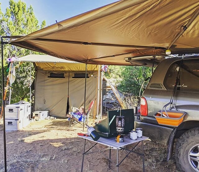
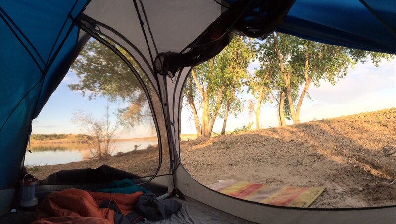
It was sort of a maiden voyage for our (used) LX (Landcruiser) and our new Springbar tent, and we were so excited about the performance of both.
But never mind my excitement. You can see for yourself below why this is a trip worth doing. Our friend over at Owl Expedition put together this amazing video that gives you a perfect idea of what this trip has to offer.
Our camping itinerary: Albuquerque - Cabezon Peak
We started out from Albuquerque and headed for Cabezon Peak off road 550. The Google Map directions are pretty straightforward - you just have to keep a close eye on the BLM dirt road since there are a few places where it’s possible to make the wrong turn. But as long as you aim for the peak right in front of you, you should be fine.
The peak which is a volcanic plug doesn't appear all that significant at a distance. But once you get closer you are struck by how big the base of the plug actually is. You can see the sudden and steep rise in the topographic map below.

A topograhip map of Cabezon Peak, NM, shows how much and suddenly this peak rises out of the ground.
There is only one entrance road to the trail that leads around the plug, but you can camp anywhere here because it’s BLM land. However, having driven to this peak a few times now, I still haven’t seen any obvious great camping spots aside from the entrance road close to the parking lot/trail-head. The land around the peak is marked by many flood canyons and uneven terrain. There is plenty of level ground and space near the entrance, though.
You are in flat open plains here, so make sure to check the wind speed and direction when you visit (the spring is notoriously windy in New Mexico). But you can create a lot of shelter with your car which is what we have done.
Hiking around the base of Cabezon Peak
The topographic map above also shows you the marked hiking trail which leads around the peak. I highly encourage you to do this hike, but not mid-summer and mid-day. It gets hot out here so prepare accordingly.
Some people actually manage to climb to the plateau top. We attempted this during our first visit, but had to give up because we couldn’t lift our dog up or down after a certain point. But we met people of all ages and fitness levels who claimed they had made it to the top, so if you are up for a good steep challenge, you should definitely go for it.
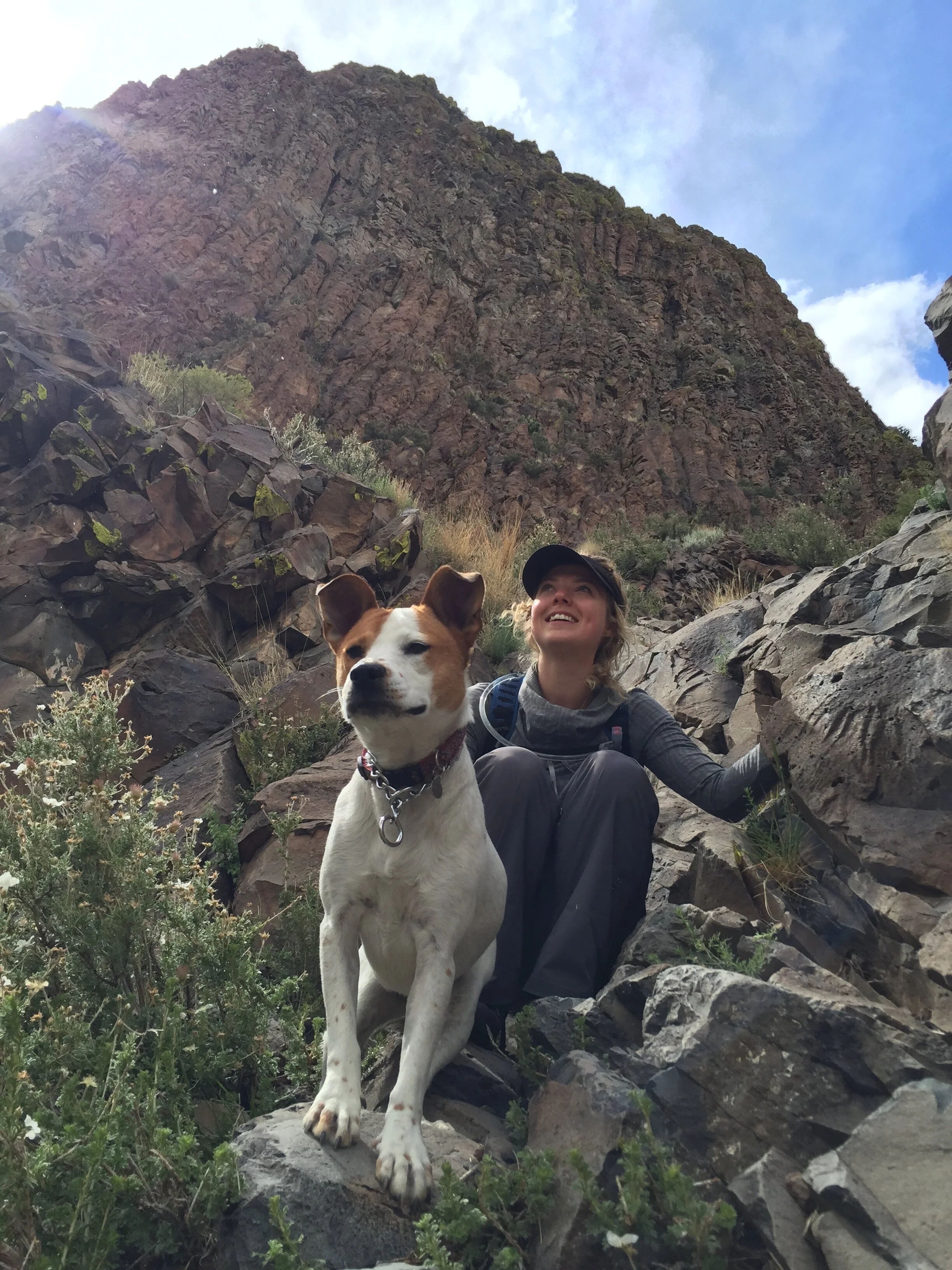
The decent from our failed attempt of climbing the peak. Don’t bring a dog if you want to make it to the top of Cabezon Peak, NM.
Our itinerary: Cabezon Peak to Mt. Taylor, NM, on the Continental Divide
From Cabezon we got on the BLM dirt roads towards Mt. Taylor and started a gradual climb. Again, you want to make sure you have a good map of the dirt roads that take you there (San Luis to Guadalupe to BLM rd 1103 to Forest rd 239) since there are surprisingly many intersections that may confuse you. We battled our first time around, but not the second - we came prepared the second time with a downloaded map.
Make sure to watch the video above for the views from this section. They are breathtaking.
As you climb you enter a different terrain and start reaching the national forest and tall pines. The forest road was overall in good shape, but it had some rough patches which not all vehicles will be able to make. Our old Jeep Cherokee as well as our Landcruiser had no problems. But check the road conditions with the local ranger (the Mt. Taylor Ranger district of the Cibola National Forest) before you go. Most of these roads in the National forest are impassable during winter and most roads require a 4x4 or at least a high clearance all wheel drive vehicle. The forest roads are in much better shape when you enter this area from the south (Grants/I-40).
Driving the Continental Divide, NM
The Continental Divide Trail spans 3,100 miles across 5 states between Mexico and Canada. You will see a lot of backpackers walking the 45 mile section that you find in the Mt. Taylor Ranger District within the Cibola National Forest in New Mexico.
Driving the Continental Divide means that you are on a part of a series of mountain ridges stretching all the way from Mexico to Alaska. This divide marks the separation of drainage. From here, water empties into the Pacific Ocean or Bering Sea to the West, and to the Arctic or Atlantic Oceans or the Gulf of Mexico to the East.
La Mosca Lookout and blocked roads
We went via Forest Service Road 453 to La Mosca Lookout which is a high mountain peak at an elevation of 3.364m (11,036ft) with a lookout tower. This is one of the highest mountain roads in New Mexico and it offers extraordinary views. Make sure to check the weather forecast before you go here since you are very exposed to the elements and lightning is likely to strike.
However, we had to conquer a fallen tree first which blocked the road. This seemed like a fun challenge for the guys who were eager to verify the power of their Landcruisers. With the help of two trucks and some tow straps, that log stood no chance. The forest service actually arrived to chop it up and were happy to get get some help getting it out of the way.

Spectacular views at La Mosca Lookout, NM
Camping in the Mt. Taylor Ranger District - Cibola National Forest
I’ve actually forgotten the exact coordinates for where we set up camp. But this forest is a haven for dispersed campers since it offers so many options along the way. We like to not see any traffic where we set up camp, so we always aim for offshoots (little forest roads off the main forest service road). Dead end roads don’t get the same traffic, and you often find signs of existing camping spots here. You see many great spots along the main forest road too, some in full sun, some in the trees. We even spotted some RVs and trailers, so the road conditions are decent enough, at least when you enter the area from I-40/Grants. We didn’t have a specific spot planned, but found a small clearing on high ground off a dead-end forest road.
Hiking the Gooseberry Springs Trail, Mt. Taylor
From our camp spot near the La Mosca Lookout we headed for the Gooseberry Springs Trail via Forest Service rd 453 and 193 (via Rd 547). All these forest roads are normally in really good shape, especially 193. Our goal was to hike to the peak of Mt. Taylor, a steady, moderately steep hike that climbs 2000 feet to the summit at 11,301-foot elevation. The round trip hike is 6.2 miles so expect to be out there for 4-6 hours. Sadly, a couple of miles into the hike we were forced to turn around because of thunder. We did manage to do this hike at a later camping visit - this time with a second baby at 2 months old. I highly recommend this hike, but check the weather forecast, bring lots of water and snacks, know your limits and bring an extra layer. It gets cold at the top.
How long did it take to drive from Albuquerque - Cabezon Peak - Gooseberry Springs Trail (Mt. Taylor)?
From the Gooseberry Springs Trail it was an easy drive back to Albuquerque. We spent three days and two nights at a very leisurely pace with dogs and an 18-month-old on this trip, and it was very enjoyable.
As i mentioned earlier, we had to return home one day early during our first attempt, so we know that this itinerary can be done in two days and one night as well.
Look up potential spots for camping off the main forest road before you go, just to have some secluded options for busy weekends. But it’s a huge area with lots of camping opportunity, so I wouldn’t worry about not finding a spot.
Find potential secluded camping spots in advance
I would scout for a few potential camp spots before you go. We went here on one of the busiest camping weekends of the year and didn’t have any problems finding a place. But with campgrounds still closed because of Coronavirus, there are more people out there competing for the same easy-access spots.
Look for existing spots off the main forest road. Remember, the roads from the south are in better shape then further north, so if your vehicle allows you, I would camp in the northern section of the region.
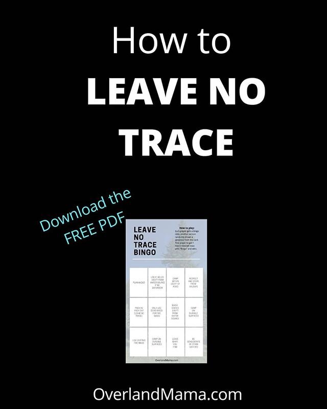
If you are not sure how to look for your own dispersed sites, check out my post on How to Find Dispersed (Wilderness) Camping Spots.
I use Google Maps Satellite view and the free online backcountry map Caltopo for this.
Happy camping planning!
Share your adventures with me
Let me know where your adventures take you and your family and share the love. Use #overlandmama, #dispersedcampingplanning or tag me @overlandmama.
Follow our adventures here: